With CANVAZ 2015 well underway, I thought I'd create this thread for photos. I have plenty to share from our Saturday (10/10/15) green trail run, which was Rattlesnake Canyon led by RBDuffer (Randy). We had a small but very fun group, consisting of myself, RBDuffer, Sage Bromax, Alex, JVR and one of the Arizona members named Chantel (sorry if I butchered the spelling of your name) who's screenname I don't know.
Most of the different trail groups met up at the Vons parking lot at 0900 in Big Bear Lake. We had a nice sized crowd of Xterras, Frontiers and other vehicles, and eveyrone had a good time meeting each other and checking out rigs before we all departed. This photo doesn't do justice to the size of group we had.

CANVAZ 2015
The groups broke up and headed to their respctive trail heads. Our group proceeded north out of town and took Highway 18 down into Lucerne Valley. From there, we took Highway 247 over to the Rattlesnake Canyon trail head. It was about a 45 minute drive from the Vons, and was quite scenic, especially for those of us who have never traveled that way out of big bear before.

CANVAZ 2015
Once at the trail head, we aired down:

CANVAZ 2015
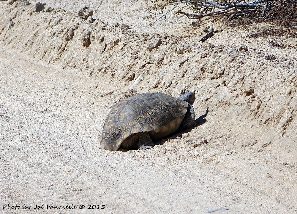
A short ways in (before we even hit the wash), we had our first and only wildlife encounter - a massive desert tortoise. I've seen quite a few of these by now, and this was by far the largest I've seen. He was big and healthy, with a shell that was about 12" in diameter. Fortunately, he was off to the side of the road well enough for us to get by without spooking him.
CANVAZ 2015

CANVAZ 2015
We hit the wash and continued on:

CANVAZ 2015
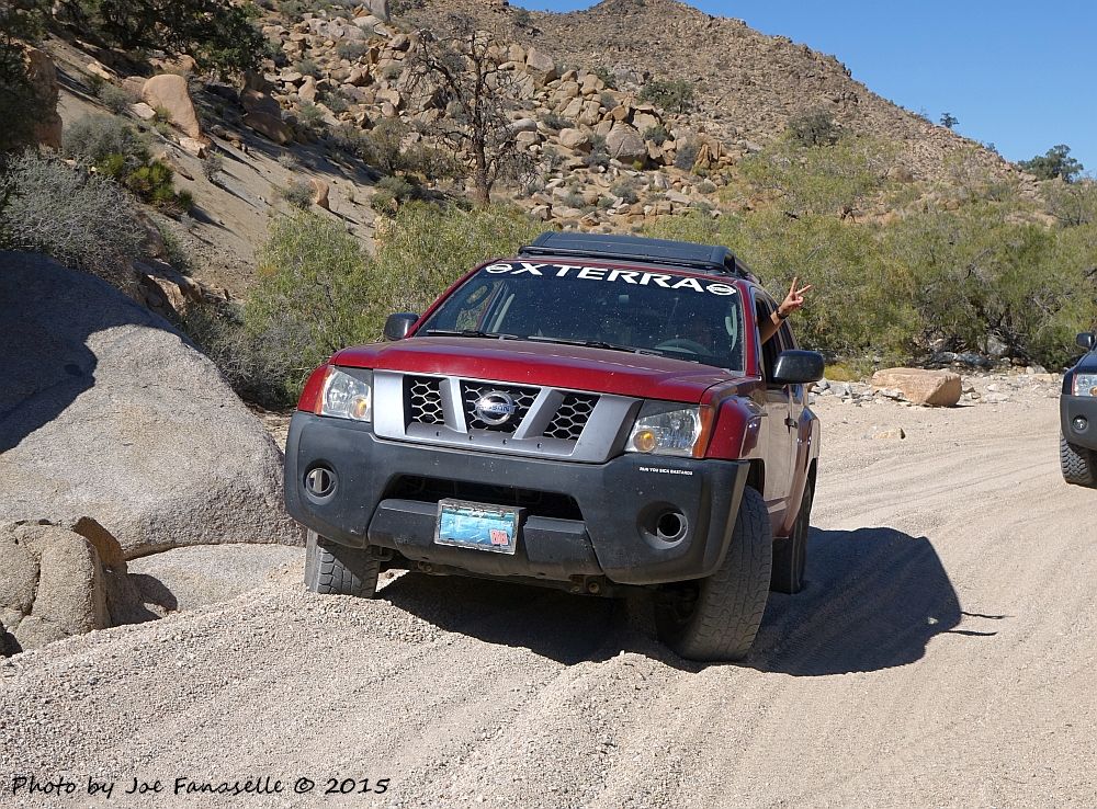
The sand claimed one victim, but it was a very quick recovery and we were on our way:
CANVAZ 2015

CANVAZ 2015
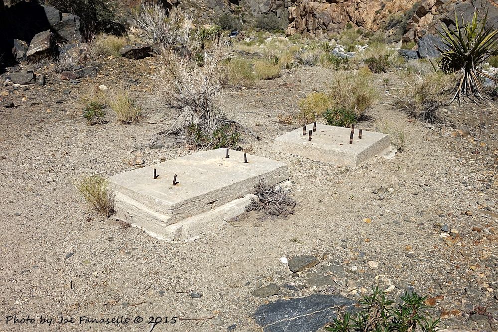
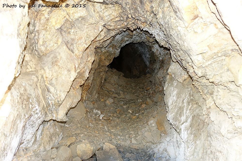
A bit firther back in the canyon (just beyond the "poser rock" spot we stopped at when we ran this trail a couple of months ago), we spotted some small concrete slabs that looked like the used to hold mining equipment. Sure enough, a quick poke around and we found a nice mine shaft hiding behind some brush:
CANVAZ 2015
CANVAZ 2015
A few of us ventured inside, where our resident geologist (Sage Bromax) did some quick analysis and came to the conclusion that they were likely mining for gold, using a chemical leeching process to get small flecks of gold from very hard material. Based on the lack of cyanide pits or other equipment at the site, we believe the ore was crushed up and hauled somewhere else for processing.

CANVAZ 2015
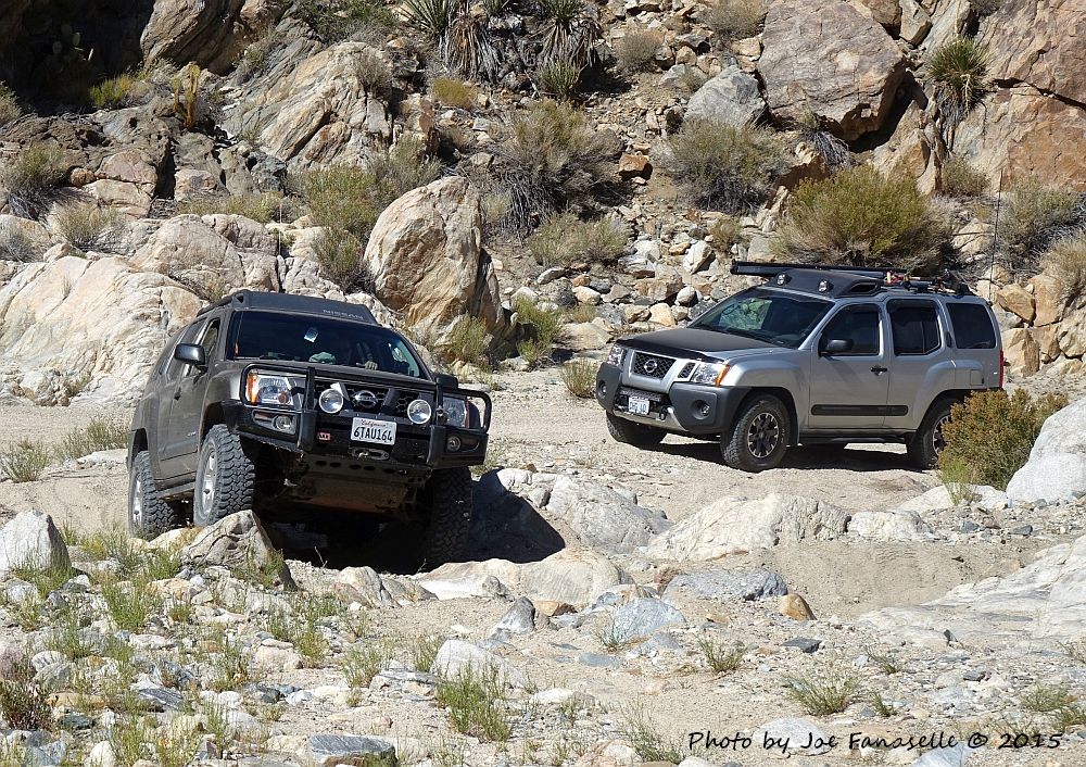
From there, we moved on. RBDuffer and Sage Bromax had a little fun in one of the off-chute rock gardens:
CANVAZ 2015
CANVAZ 2015
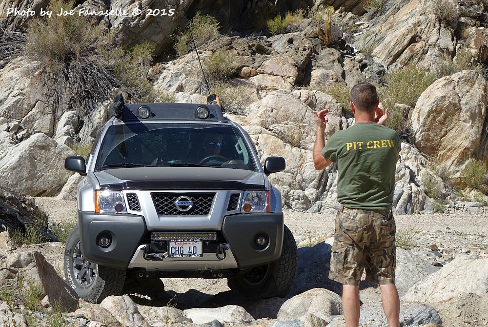
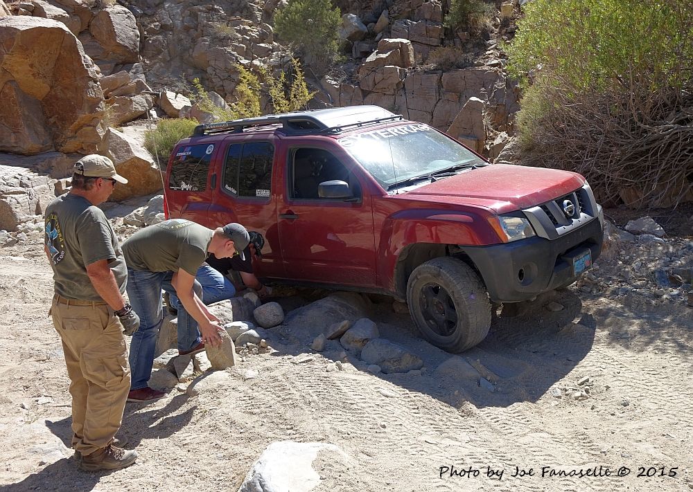
A little further up the road, we came to the one spot that we all expected would prevent a little difficulty. The spot involves some technical crawling over some rocks to get through a few portions of the road. With some careful spotting from Randy, some rock stacking for Chanel's rig (which is still stock height and 2WD), and some great work by all of the drivers, we made it through with no issues:

CANVAZ 2015
CANVAZ 2015

CANVAZ 2015

CANVAZ 2015

CANVAZ 2015

CANVAZ 2015

CANVAZ 2015
A bit further up the road, once we got into the area where the joshua trees start to get plentiful, we took a small side road and found a great lunch spot:

CANVAZ 2015

CANVAZ 2015
We explored the side road further, but it came to a dead end at the forest boundry due to that portion of the forest being wilderness area. The topo maps showed a spring and some old structures a bit further up, but it would have required a short hike to get there and we opted not to do it, as we still had a lot of ground to cover. We headed back to the main road and continued on.
A short distance later, we came to the section where there are few fun side roads with steep climbs and descents. A few of us climbed some of the trails and a some rigs got some great three wheel action going back down the other side:

CANVAZ 2015

CANVAZ 2015

CANVAZ 2015

CANVAZ 2015

CANVAZ 2015

CANVAZ 2015

CANVAZ 2015

CANVAZ 2015

CANVAZ 2015
We met up with 2N02 Burns Canyon, and quickly discovered a large sign that was knocked over. Based on our assessment, it looks like some knucklehead used a winch to pull it out of the ground, but it was still intact. With 2N02 being our adopted trail, everyone agreed that we should take advantage of the size of group we had and get it fixed. So we dug new holes and uprighted the sign, burying the concrete deep this time. As soon as we get a nice rain, it should pack the dirt in nicely and hopefully the sign won't go anywhere for awhile:

CANVAZ 2015

CANVAZ 2015

CANVAZ 2015

CANVAZ 2015

CANVAZ 2015

CANVAZ 2015
A job well done!


CANVAZ 2015
We continued along 2N02, stopping a few times to check a few things out and take in some of the views:

CANVAZ 2015

CANVAZ 2015

CANVAZ 2015

CANVAZ 2015
Rather than continuing on Burns Canyon all the way back to Baldwin Lake, we decided as a group to take the Smarts Ranch cutoff, which runs parallel to Burns Canyon just a little further to the northeast. The road is listed as a blue trail on the maps. It was all downhill for us the way we went. It was a bit rocky, but everyone haldled it with ease.

CANVAZ 2015

CANVAZ 2015
Once we got back to highway 18, we headed back into town where I broke off from the group. They headed back to camp and my wife and I headed back down the mountain. It was a wonderful day and an amazing trip, and I can't thank RBDuffer enough for leading us along and thank the whole group for such an amazing day!